Showing posts with label Discovery. Show all posts

Unique Banyan Tree of Akhaura

Unique Banyan Tree
Debagram: Akhaura: Bangladesh

Last year on the victory day(16-12-2012), I had gone to Akhaura to see the border side villages. I walking though an unknown street inside Akhaura Municipality to reach the main road. I rarely know this place thus I ended up at an entrance of a Shiva Temple, and there was the tree waiting for me to view with charms. 


Usually Banyan Tree (Ficus benghalensis) a native tree of Bangladesh have unique fruit structure and are dependent on fig wasps for reproduction. The seeds of Banyans are dispersed by fruit eating birds. The seeds germinate and send down roots towards ground, which may envelop part of host tree and building structure. This nature of banyan tree often creates very impressive, eye catching and unique outlook with very mystical value. 


Sight by walk take me to an unique Banyan tree in the premises of the temple. There is the surprise for me. The Banyan tree covers the entire Shiva Temple by it's roots and branches in a natural geometry.There are four passage to go inside this single chambered 15 feet tall temple, without those entrance almost Tree  jacketed every bricks and plasters, it is awesome. 


I was so interesting to know more about this master tree.  It is the time of sunset, there were two children playing at the premised, they could not provide me the exact date of building this typical but very interesting Shiva Temple. I assumed that the temple is some 150 years old, and the Banyan tree is more than 80 years old. There is a electric lamp hanging and fixed into the trees branch without any base for night lighting, interesting.


My following amateur YOUTUBE video might give the redears better idea about how interesting an unique the Banyan tree is, enjoy:


Here is the location of This Latest Sight by Walk Finding: Google Map

Jaintapur : Megalithic Monument of Bangladesh

Remnant of Jainta Dynasty : Only megalithic monument of Bangladesh
Jaintapur : Sylhet : Bangladesh

Jaintapur is a famous place at the Jainta foothill of Sylhet region in Bangladesh.It is located 40 kilometres north of Sylhet divisional town, Jaintiapur is only 5 kilometers past from Jaflong. Now this place is official Upazila(sub-district) of Sylhet District. The name 'Jainta' reminds the strong presence of a powerful kingdom, known as Jainta Kingdom. This place served as the of Jainta Kingdom once(at 18th Century). 


History
Due to its geophysical condition the region remained independent for a long time and was well known as Jaintapur Kingdom. As such it was mentioned in Epic, Puranic, and Tantric literatures. However, a number of local legends, folk tales, and inscriptions suggest that from approximately the 7th/8th century AD Jaintapur came under the control of Kamarupa Kingdom and that later it went under the control of the Chandra and Varman rulers. After the fall of the Varmans, Jaintapur was again ruled for some time by the Deva dynasty. Jayanta Ray, the last ruler of the Deva dynasty, had a daughter named Jayanti, who got married to a son of a Khasi chief, named Landowar. Due to this matrimonial alliance, Jaintapur kingdom went under the control of the Khasis in c 1500 AD. Subsequently, Khasi kings ruled over the kingdom independently till the British occupied it in 1835.{Banglapedia}
Remnant of Jaintapur Palace
The Megalithic Monument of Jainta
This regal place bears the remnant of Jainta Kingdom, so far the dilapidated Rajbadi or King's palace, Jainteshvari temple, and megalith ie monuments. Among these three, megalithic monument is the best heritage structure in that region. It is the only megalithic monument  of Bangladesh. According to&Syed Rezaul Kabir Rana of Jahangirnagar University-
...This megalithic assemblage is outstanding and bears uniqueness among the Asian megalithic culture. In the context of India and Asian region, this culture comprises a great variety of styles.The megalithic instances with stylistic features found in Jainta, close to the Khasia Hills, are among the richest regional varieties. Here we find unique types of stands, dolmen and menhir that are rare in other megalithic findings in Turkey, Ireland, Portugal, Germany, Netherlands and Denmark.  
Megalithic Monument :  picture is taken around 1990's, from Bagnlapedia
The date of Jaintapur megalithic cultural assemblage has not been determined. But we are hopeful that we can easily deduce the time and cultural practices mainly the burial and sacrificing attitude of the then people through study of artefacts yielded from the excavation. The megalithic cultures earlier recorded in India and other Asian sites go back to 1500BC to 100AD.{The Daily Star}
Megalithic Monument: Nowadays January 2012
Nevertheless among the cultural remains of Jaintapur are a few megalithic monuments that are worthy of mention. Megalithic structures are defined as graves or commemorative monuments made by large and small stone chunks. These structures can be seen throughout Asia, Africa and Europe. In different parts of the Indian subcontinent these are present in large numbers and their form and spatial distribution have proved extremely valuable in the re-construction of past cultures, especially after the beginning of the Iron age in India. The only megalithic remains discovered so far in Bangladesh are the ones in Jaintapur.{Banglapedia}
Following Video is a best on web, I found on the cultural remnant of Jaintapur, By Fazlul Karim, I hope many will like this one.


Photo Courtesy: Kazi Rabeya Ame | Google Map(Still blurred)

Bostami Turtle : the last stand

Bostami Turtle : the last stand
I had a chance to visit Chittagong last week. This time I was focused to revisit the shrine of Saint Bayezid Bostami, to see the popular and rare black soft shell turtle with more attention. I was interested about this endangered and almost extinct species and learned that the pond of Bayezid Bostami is not the only place left for this beautiful creature.


black soft-shell turtle  2
Taken from the shrine of Bayezid Bostami. Do you think this is the largest tortoise ;)
Zoological ID
Black soft shell turtle also known as the Bostami turtle in Bangladesh (after the saint of Bayezid Bostami), is a fresh water species { Aspideretes nigricans(=Trionyx nigricans), of the family Trionychidae, order Testudines} It was believed to be an endemic species. The wild population is almost extinct from the world.
The population shows two colours: one with dark brownish-black carapace and the other olive-greenish; the carapace of hatchlings is predominantly light olive-green but marginally darker and having four distinct ocelli on the carapace consisting of five concentric rings.The nesting season extends from February to May.). Incubation period varies from 96-106 days.


Social Importance
This turtles has some religious value in Bangladesh. Turtles of Chittagong is protected and taken care by the Shrine authority-'' the mazar committee', they don't allow any scientific research, or any specimen for breeding in wild. Moreover, many of them believe that these 'mazari' turtles are the descendants of the sinners, who are turned into turtle miraculously by the Saint at 13th Century. Many tourist visit the pond to see and feed them for their such religious value.  There is another local belief is very popular about these reptiles, that if any person feeds them and the turtles take the meal, than his will come true. Though these turtles never take the given bread or any other meal, if they are not hungry.  

black soft-shell turtle 1
No! they are not largest tortoise like the Galapagos

Last Habitat
Some 300 turtle is living in the attached pond of the Shrine of Bayezid Bostami; however, still there is another artificial habitat is found in Gowhati,Assam, India, beside the Kamaksha mandir.
According to wiki there are three habitats left for this turtles, all are situated in India and Bangladesh. Huge population is survived in two ponds and according to another source, it is believed there are few lives in the wild environment at the River Jia Bhoroli, a northern tributary of mighty Brahmaputra. This turtle was also found in Arakan River System. So the spotted habitats are:

  1. Srine of Bayezid bostami , Chittagong , Bangladesh
  2. Nilachal Hill , Gowhati, Assam, India
  3. River Jia Bhoroli, Assam, India
This could be the last stand for this beautiful reptiles.
---
References : Banglapedia | Wiki | For Google Earth

Living Bridge of Roots : Mawlynnong

Living Bridge of Roots 
Mawlynnong : East Khashi Hills : Meghalaya : India


Introduction
Mawlynnong is a village in East Khasi Hills district of the Indian State of Meghalaya, a hilly village of Jainta Hill series, so close to the Northern boundary of Bangladesh; is the cleanest village of Asia[Wiki]. It is a naturally gifted place with so many scenic views. This is village is also famous for the living bridge of roots, exclusively found only in Mawlynnong, pure natural wonder. Not just one, there are several root bridges in the surrounding of that village.
  
Photo : Kaikobad from Panoramio
Famous Double Decker : Cherrapunjee.com
How the Bridges Made
These are mainly rubber trees(Fiscus elastice). This tree can comfortably perch itself on huge boulders along side the riverbanks or in the middle of rivers and send its roots down to the riverbed. Thus, they have adapted themselves very well to high soil erosion caused by these fast flowing rivers and streams that come down about 3000 feet along precipitous slopes. These trees shoot out many secondary roots from their trunks.


Cherrapunjee.com
The early war-Khasis, had noticed these qualities of this tree and had adapted it to serve their need for bridges to cross rivers and streams. In order to direct the roots in the desired direction, betel nut tree trunks, sliced half in the middle for their entire length, are hollowed out and are positioned according to the requirement of the bridge. The thin and long tender roots are then passed through these hollowed out betel nut tree trunks. The roots start growing towards the directed end. When they reach the other end of the stream or river, they are allowed to take root in the soil, given enough time to get stength and strudy , living bridges are produced. Some of them take ten to fifteen years to become fully functional.


Here is a youtube presentation of ginesete:


Capacity and Length
These root bridges are so strong that some of them can carry 50 or more people at a time. We have some of them are 53 feet, 56 feet, 70 feet and even over 100 feet long. Villagers use some of these bridges for daily work for more than 500 years. 
Seema K K from Flickr 
------

Great Blue Hole of Belize : World's Largest

Blue Hole
A blue hole is a submarine cave or underwater sinkhole. They are also called vertical caves.Blue holes are roughly circular, steep-walled depressions, and so named for the dramatic contrast between the dark blue, deep waters of their depths and the lighter blue of the shallows around them.(Wiki)There are many different blue holes located around the world, from Belize and the Bahamas to the Red Sea.

NatGeo

Great Blue Hole
Among these blue holes- Great Blue Hole of Belize is believed to be the world’s  largest  sea-hole . Its almost perfect circular shape made it very popular amongst tourists who often visit this place. This place is most attractive for scuba divers who are exploring the depths of this hole. It is known that there are a plenty of cave networks in this place. Divers are also attracted with plenty of rare animal species and forms of life which can be found only in this place.

NASA Earth Observatory
Location
 It lies near the center of Lighthouse Reef a part of Belize Barrier Reef Reserve System, a small atoll 70kilometres (43 mi) from the mainland and Belize City.


Shape and Size
The hole is impressively circular in shape, over 300 meters (984 ft) across and 124 metres (407 ft) deep. Geologist found out that , it has been created as a cause of sea level increase about 65,000 years ago.

Following youtube video may help the readers and viewers, to visualize this blue hole with some good narration and geographical facts.  This Natural Wonder is a world heritage site of UNESCO 
---------------------

Bhitargarh : 1500 Years Old Buddhist Monastery

I went to Bhitargarh in 2004, the academic tour from my University. Recently I take another trip there.  I did a little study that time for preparing my study tour report. I quote some text from Banglapedia here, but the description in banglapedia is not enough for curious readers, if one does not go there and see it by his own eyes. I suggest - rainy season is the best time for travel to that place. Now I feel people should know about this place, so here is my little attempt to let people know about this interesting place of northern most district of Bangladesh. 
..................................................
Relative Location
Bhitagarh Fortification,built in the sixth or the seventh century, 16 kilometres south of the Panchagarh town, is under Amarkhana union of the district sadar upazila,this place is the biggest fort city of Bangladesh.
.................................................
Brief History 
Bhitargarh Fort  formed a part of the chain of early medieval mud-forts erected mostly by the Muslim rulers at different times to defend their territory against the incursion of their northern Hindu neighbours. The territory east of the Karatoya River was for sometime a part of the Ahom kingdom. In the15th century this area was included in the Tibeto-Barman Khen dynasty's territory and served as a sort of buffer state between Assam and the Muslim Kingdom of Bengal.


"The existence of fifteen garhs (fortifications) has hitherto been traced of which the most noted are Bhitar Garh, Hosain Garh, Mir Garh, Rajan Garh and Deven Garh. Panchagarh is named after these five garhs. Amongst these fortification Bhitargarh is still vigilant archeological site. Total Garh is bounded by both manmade and natural canal and fort like wall."-Banglapedia.

Bhitargarh fort city, established in the sixth or seventh century, had a sovereign administration. Built on important trade routes, the fort city had trade links with Tibet, Bhutan, China as well as with West Bengal, Bihar, Sikkim and Punhdrabardhan of India.

.................................................
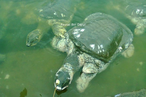
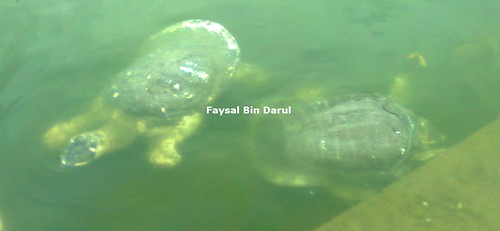
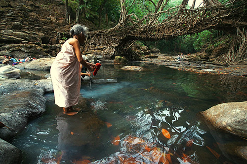
The entire fort city is bordered by two rectangular wall- inner and outer wall or fortifications. There are two villages inside the wall- Bhitargah and Maharajar Hat, with village market (Bhitargarh bazar ).Most interesting feature is the Maharajar Dighi. Which is a large pond,the most attractive place inside the fortification. It is really beautiful during rain. Probably the Maharaja(king) of Bhitargarh, dug the canal for supplying sweet water inside the fort. the pond might be connected by drainage network. 
.................................................
Recent Findings
The fortification is now the most important archeological site of the country. The place comes to spot light after a recent excavation program , which has been uncovered some 200 archeological site inside the fort city.


The site shown in image, is assumed to be the royal buddist monastery , loacated beside the ruins of KACHARI(administrative building for collecting tax and ravenue) of Maharaja;s Palace 
Among these sites , there are several temples and buddist Stupa has been discoverd. Archeologists hope to discover the biggest Buddhya Bhiara in the most northern region of Bangladesh.Samples collected from the sites are significantly different from those of Paharpur and Mainamati Bhihara. It is also assumed that the bhihara and its surrounding could be bigger than Mainamati Buddhist Bhihara.
This biggest fort city had a sovereign administration. Built on important trade routes, the fort city had trade links with Tibet, Bhutan, China as well as with West Bengal, Bihar, Sikkim and Punhdrabardhan of India.

Here is Youtube video in Bagnla, with some good footage:


-------------------------


News and Image Source : The Daily Prothom-alo | The New Age | ULAB
For Google Earth View Click Here<< ,In Google Map

Britain's 1000 Years Old Fish Trap

Well the following post is not an usual sigh by walk post. I like to post it here because it is an interesting subject. Last week I was checking the National Geographic Content of GEC. I was making a concept of posting about traditional African fish trap for GEC. So I searched for rich text about the fish trap, especially the local fish traps widely used in Central African region. But I found this interesting one :

Britain's most ancient fishing trap has been discovered while a strange underwater shape was spotted from a plane flying overhead.This millennium old archeo-site is located beside Popit sand beach near the Teifi estuary, near Cardigan, West Wales the coastline.

Research carried out on Google Earth.The place is discovered at March, 2009.

The 853ft (260m) long construction is thought to have been built 1,000 years ago,around the time of the the Norman Conquest and designed to trap fish behind rock walls.The trap is believed to have been made from locally quarried rock, or possibly boulders carried in by glaciers during the last Ice Age.

Archeologists believe large numbers of people worked together to erect this long rock-built contraption and it allowed them to catch plentiful numbers of fish for their supper.
The discovery has given them a fascinating glimpse into how medieval communities survived through hunting and fishing.


Fish swam into the estuary but became trapped by the outgoing tide before being hooked out using nets.
====================
Curious reader's may love to see the news, which has published in : Daily Mail , Telegraph 
(oops ! BBC page is expired)  KMZ for Google Earthholics
================
Google Earth Blogger Frank Taylor wrote about it here shortly.

Related Posts Plugin for WordPress, Blogger...